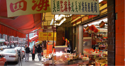
CARRALL STREET
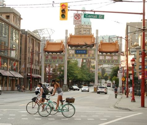
CARRALL STREET was named after Dr. Robert William Werr Carrall who was a doctor, politician and delegate to Ottawa in 1870 to discuss the terms of British Columbia's union with Canada.
-Water Street was named arbitrarily on a fire insurance plan of Granville, British Columbia, August 1885, and published by Sanborn Map and Publishing Company Limited (Map 14258), it lay where the present Carrall Street is (north of Hastings Street).
MAIN STREET
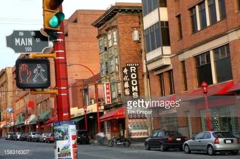
MAIN STREET was formerly named Westminster Avenue, and South Vancouver but by 1910 it was renamed to Main Street. Nelson says that the Main Street Improvement Association was instrumental in having Westminster Avenue in South Vancouver widened from sixty to eighty feet and in changing the name to Main Street. The belief was that 9th Avenue and Westminster Avenue ,which is now Broadway and Main Street, would become the centre of a grand metropolis. Later came attempts to rename it. On 30 December 1940, city council recommended that the Special Committee on Street Names, when preparing the official street name map, give consideration to the proposal that the name of Main Street be changed to Westminster. However, because of the exigencies of the war, the map was not prepared. The Street Naming Committee, on March 1948, requested that the chairman, Alderman Halford Wilson, approach Mount Pleasant Chamber of Commerce and ask it to canvass merchants on that street for a suggestion about a name change. There is no record of any action being taken. Westminster Avenue. Named on "Plan of the City of Vancouver, British Columbia, " compiled by H.B . Smith. It extended south from Alexander Street to the city limits and into South Vancouver. Likely so named because it met the New Westminster Road (now Kingsway) at Broadway, and, indirectly, after Westminster, England, the seat of colonial power.
GEORGIA STREET
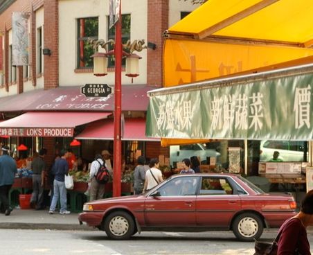
GEORGIA STREET was named in 1886 after the Strait of Georgia, shown on the map used by L.A . Hamilton . The street lay between Chilco and Beatty Streets. It extended east to Boundary Road and renamed Harris Street.
-Harris Street was named after Dennis Reginald Harris, who was a shareholder in the Vancouver Improvement Company and was appearing in the first Vancouver Voters List in 1886. A civil engineer for the CPR , he later became city engineer for Victoria and was involved in real estate. The street changed to Harris Street, between an arm of False Creek and present Main Street, to Shore Street.
-Shore Street, the descriptive name lasted from 1908 to 1915 but was not in general use. The 1909 city directory still listed the 100 block Harris Street as having several women as residents. It was named in response to a petition from residents "praying that the name west of Westminster Avenue be changed so that the evil shade that hangs over the association of the street name with 'restricted district' may not extend to the sections where reputable residents are dwelling"
PENDER STREET
PENDER STREET was named after Pender Island, Pender Island commemorates Daniel Pender, who was a staff commander (later captain) of HMS Plumper, which surveyed the B.C. coast in 1857-70. Pender Street extended both Dupont and Princess Street were renamed Dupont Street.
-Princess Street was named in 1888 and also renamed a portion of Dupont between Main Street and Vernon Drive because of the horrible reputation of Major Charles Dupont. On 20 September 1937 Major J.S. Mathews recorded a conversation with Mrs. Stephen Ramage (nee Annie Sanders, daughter of alderman Edwin Sanders), who stated that Princess Street was named after her nickname.
- -Dupont Street was named in 1886 after Major Charles Thomas Dupont, one of the shareholders in the Vancouver Improvement Company.
-Princess Street was named in 1888 and also renamed a portion of Dupont between Main Street and Vernon Drive because of the horrible reputation of Major Charles Dupont. On 20 September 1937 Major J.S. Mathews recorded a conversation with Mrs. Stephen Ramage (nee Annie Sanders, daughter of alderman Edwin Sanders), who stated that Princess Street was named after her nickname.
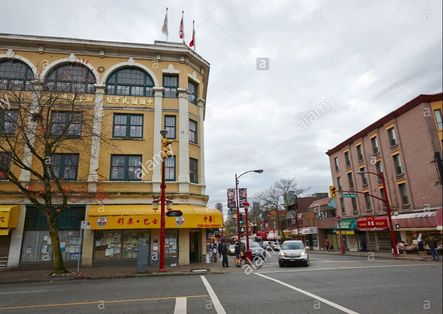
KEEFER STREET
KEEFER STREET was named after George Alexander Keefer who was a property owner in DL 196 and shareholder in the Vancouver Improvement Company. He came to British Columbia in 1871 to survey a route for the CPR and to handle its construction from Boston Bar to Lytton. He opened a private engineering practice in Vancouver in 1886. In 1929, changed the part between Vernon Drive and Victoria Drive to Frances Street, and that between Victoria Drive and Nanaimo Street to Ferndale Street. In 1984, Plan L F 9511, extended Keefer west to Taylor Street; and in 1992, Plan L F 11491, further extended it to a cul-de-sac beyond Abbott Street and changed the entire section west of Carrall to Keefer Place.
HASTINGS STREET
HASTINGS STREET perpetuates the name of Hastings Townsite, named by the provincial government in the 1860s after Rear-Admiral, the Honourable George Fowler Hastings , commander-in chief, Pacific Station. Hamilton named the street in 1886, Hastings was a well-developed road between Granville and Hastings Town- sites. In 1914, changed Seaton Street to Hastings Street between Burrard and Jervis Streets.
Seaton Street appeared on the first official map of Vancouver which was compiled by H.B. Smith. In a letter to Major J.S. Matthews, former city archivist, stated he did not remember why the name was chosen but that he might have wandered off the map he was using and chosen names of lakes. Seaton Lake , which is now spelled Seton, was named after Colonel Alexander Seton, who commanded the soldiers on the ship Birkenhead, which sank in 1853.
GORE AVENUE
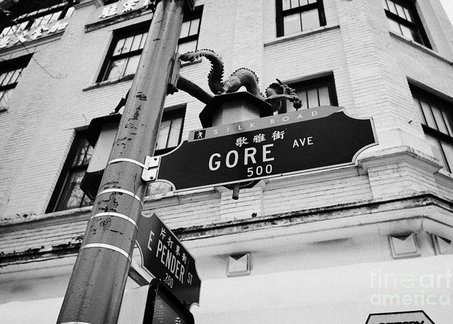
GORE AVENUE was named by L.A . Hamilton after William Sinclair Gore, who was a surveyor general of British Columbia in 1878. Henry S. Rowling in a letter to Major J.S. Matthews, sent in on 16,May,1932, mentions that there was a skid road from False Creek to Burrard Inlet near the present Gore Avenue. The existence of this road probably influenced the surveyor to run Gore Avenue at an angle in relation to the other north-south roads.
Written by : E.H.
Posted by : E.H.
Posted by : E.H.
